Description
RTK Tablet LT800H in Uzbekistan, Tashkent
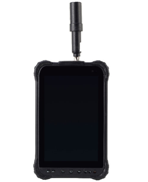
PROTECTED TABLET FOR ACCURATE DATA COLLECTION RTK Tablet LT800H
The built-in professional multi-bandGNSS LT800Hmodule provides direct, instant and reliable access to geodetic accuracy to any third party application without the need for further software development.
Rugged and versatile, it enables accurate GIS data collection, site planning, forensic mapping, environmental surveys and other scenarios.
The 8.1-inch sunlight-readable IPS touchscreen makes theLT800Hideal for collecting geodetic precision data and visualizing complex vector and raster maps in the field.
When combined withGNSSreceivers, it becomes an incredibly bright and powerful data collector. It can withstand a 1.5m drop onto concrete and is IP67 rated for daily use in harsh environments for any job, regardless of weather conditions.
The RTK Tablet LT800H is a specialized tablet designed for use with RTK (Real-Time Kinematic) GNSS (Global Navigation Satellite System) receivers in surveying, mapping, and construction applications. Here are some key features and functionalities of the LT800H:
- RTK GNSS Compatibility: The LT800H is compatible with RTK GNSS receivers, allowing it to receive high-precision positioning data in real-time. This enables accurate mapping, surveying, and navigation tasks in various environments.
- High-Resolution Display RTK Tablet LT800H: The tablet typically features a high-resolution display that provides clear and detailed visuals for viewing maps, survey data, and other information in the field.
- Touchscreen Interface RTK Tablet LT800H: The LT800H utilizes a touchscreen interface for intuitive and easy navigation. Users can interact with maps, data layers, and software applications using touch gestures and on-screen controls.
- Rugged Design: Designed for use in outdoor environments, the LT800H often features a rugged and durable construction that is resistant to dust, water, and shock. This ensures reliable performance in challenging conditions.
- Built-in GNSS Antenna: Some models of the LT800H may include a built-in GNSS antenna for enhanced positioning accuracy and reliability. This eliminates the need for external antennas and simplifies setup and operation.
- Long Battery Life: The tablet typically comes with a long-lasting battery that provides extended usage time in the field. This allows users to work for extended periods without needing to recharge the device frequently.
- Connectivity Options: The LT800H may offer various connectivity options such as Wi-Fi, Bluetooth, USB, and cellular data. These connectivity options enable seamless data transfer, communication with other devices, and access to online services and resources.
- Customizable Software: The tablet often runs on customizable software tailored to the needs of surveyors, GIS (Geographic Information System) professionals, and construction workers. This software may include mapping applications, surveying tools, data collection software, and more.
- Compatibility with RTK Networks: The LT800H can connect to RTK networks for precise positioning data, enabling users to achieve centimeter-level accuracy in their surveying and mapping tasks.
- Accessories and Mounting Options: The tablet may come with accessories and mounting options for attaching it to surveying equipment, tripods, or vehicles. This ensures convenient and secure placement of the tablet during fieldwork.
Overall, the RTK Tablet LT800H is a versatile and reliable tool for professionals who require high-precision positioning data in their surveying, mapping, and construction activities. With its rugged design, advanced features, and customizable software, it provides an efficient solution for accurate data collection and analysis in the field.
Other products in category GIS data collection