GNSS Receiver CHCNAV i93

CHCNAV i93

i93 GNSS receiver – universal RTK, consists of the latest technologies: GNSS, IMU and two cameras for even more convenient use. Built-in 3D visual layout functionality provides unparalleled ease of use and comfort, enhancing the efficiency of any site planning project.

SPECIFICATIONS

GNSS Characteristics
Channels 1408 channels
GPS L1C, A, L2C, L2P(Y), L5
GLONASS L1, L2, L3
Galileo E1, E5a, E5b, E6*
BeiDou B1I, B2I, B3I, B1C, B2a, B2b
QZSS L1, L2, L5, L6*
PPP B2b-PPP
SBAS (EGNOS support) L1, L5
GNSS accuracy
Real Time Kinematics (RTK) P: 8 mm + 1 ppm RMS

H: 15 mm + 1 ppm RMS

Initialization time: <10 s Initialization reliability: >99.9%

Post-processing kinematics (PPK) P: 3 P+ 1 ppm RMS

B: 5 mm + 1 ppm RMS

Post-processing statistics P: 2.5 mm + 0.5 ppm RMS

B: 5 mm + 0.5 ppm RMS

Differential code P: 0.4 m RMS

B: 0.8 m RMS

Standalone R: 1.5 m RMS

B: 2.5 m RMS

Positioning speed 1 Hz, 5 Hz and 10 Hz
Time until commit Cold start: < 45 s Hot start: < 10 s Receiving signal:: < 1 s
Speed

IMU updates

200 Hz
Tilt angle 0~60°
RTK with tilt compensation Additional uncertainty in the tilt of the horizontal pole is usually less than 10 mm + 0.7 mm/° tilt
Environment
Temperature Control: -40°C to +65°C

(-40°F to +149°F)

Storage: -40°C to +85°C

(-40°F to +185°F)

Humidity 100% no condensation
Intrusion protection IP67
Strikes Survive a 2-meter pole fall
Vibration Complies with ISO 9022-36-08 and MIL-STD-810G-514.6-Cat.24.
Waterproof and breathable

membrane

Prevents water vapor from entering in adverse conditions
Electric
Power consumption UHF/4G RTK rover without camera: typical 2.8 W

Visual breakdown/visual shooting: 4 W standard

Capacity of lithium-ion

battery

Built-in non-removable battery

9,600 mAh, 7.4 V

Internal battery life UHF/ 4G RTK Rover: up to 34 hours Visual breakdown/visual shooting: up to 24 hours

Base: up to 16 hours Static: up to 36 hours

External power supply 9 V to 28 V DC
Equipment
Size (L x H) Φ 152 mm x 81 mm

(Φ 5.98″ × 3.19″)

Weight 1.15 kg (2.54 lb)
Front panel 1.1-inch OLED color display 2 LEDs, 2 physical buttons
Tilt sensor IMU without calibration to compensate for pole tilt. Immune to magnetic disturbances. E-Bubble Alignment
Cameras
Touch pixels Global shutter with 2 MP and 5 MP.
Field of view 75°
Video frame rate 25 fps
Communication
SIM card type Nano SIM card
Network modem Built-in 4G modem:

TDD-LTE, FDD-LTE, WCDMA, EDGE, GPRS, GSM

Wireless connection NFC
Wi-Fi Wi-Fi IEEE 802.11a/b/g/n/ac,

access point mode

Ports 1 x 7-pin LEMO port (RS-232)

1 USB Type-C port (external power, data download, firmware update)

1 UHF antenna port (TNC socket)

VHF modem Receive/transmit: 410–470 MHz

Transmission power: 0.5 W to 2 W.

Protocol: CHC, Transparent, TT450, Satel.

Connection speed: from 9,600 to 19,200 bps

Range: typically 3 to 5 km, up to 15 km under optimal conditions

Data formats RTCM 2.x, RTCM 3.x, input/output CMR Output HCN, HRC, RINEX 2.11, 3.02 NMEA 0183 Client NTRIP, NTRIPCaster
Built-in memory 8 GB. Support 128 GB external expansion

Description

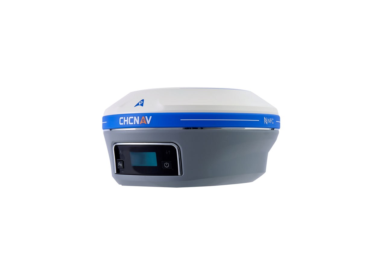
CHCNAV i93 in Uzbekistan, Tashkent

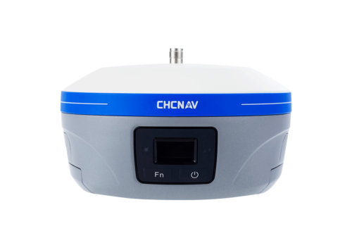
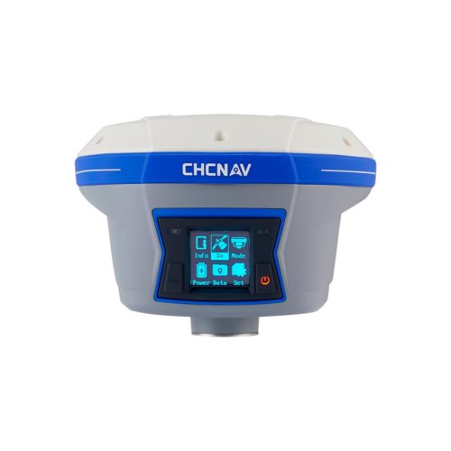
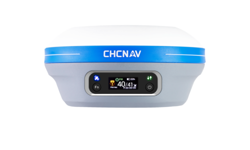
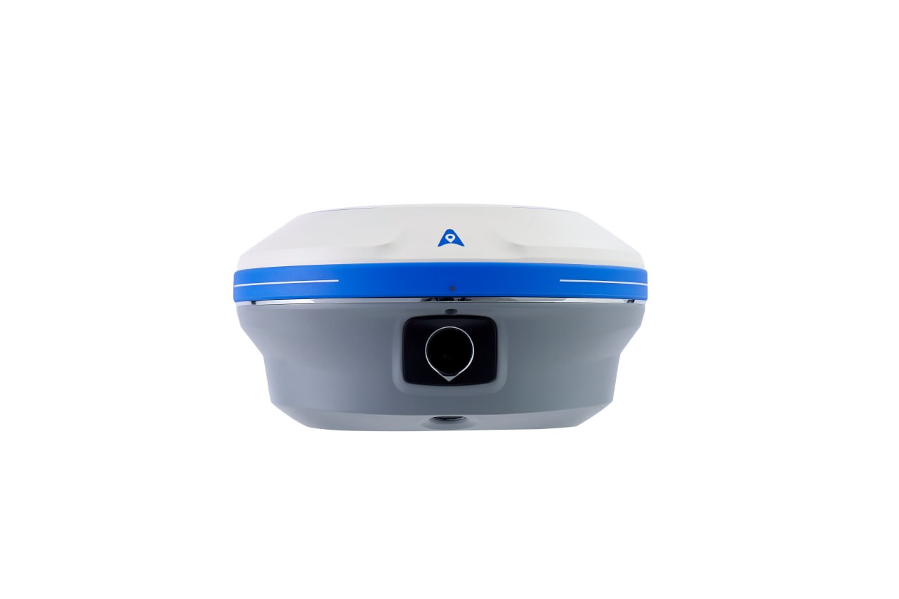
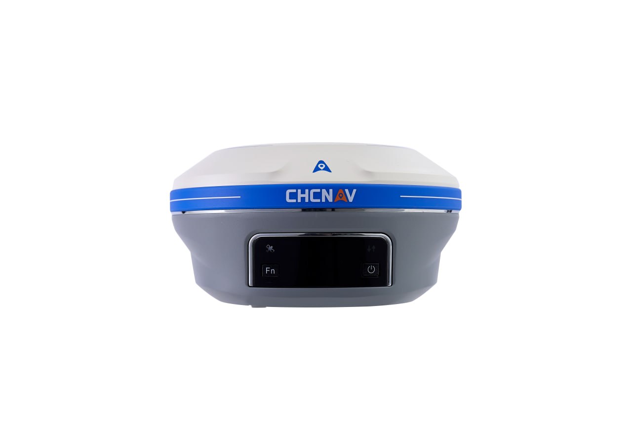
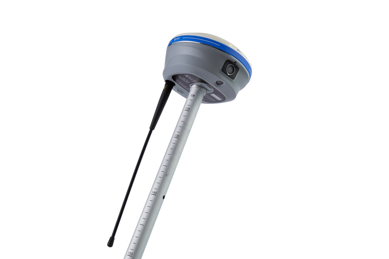
Visual surveying using video photogrammetry technology provides accurate point measurements and access to previously hard-to-reach, signal-barred and dangerous points. i93 GNSS can be used to complement aerial photography created from perspective images, as its data is compatible with the most popular 3D modeling software. The i93 GNSS receiver features the innovative CHCNAV iStar GNSS RTK algorithm, multi-band GNSS channels and a hybrid mechanism for reliable and accurate positioning even in the most challenging environments. The Auto-IMU i93 features automatic initialization, eliminating the need for manual initialization and making shooting in the field easier. i93 is the ideal solution for completing tasks faster, more accurately and efficiently.

The CHCNAV i93 is a GNSS (Global Navigation Satellite System) receiver manufactured by CHC Navigation (CHCNAV), a company specializing in professional surveying and mapping equipment. Here’s some information about the GNSS receiver:

  1. GNSS Technology: The CHCNAV i93 utilizes GNSS technology, which includes satellite positioning systems such as GPS (Global Positioning System), GLONASS (Global Navigation Satellite System), Galileo, and BeiDou. This allows for precise positioning and navigation in various environments.
  2. Model Name: “CHCNAV i93” denotes the model number or designation of this particular GNSS receiver.
  3. Multi-Constellation Support: The i93 likely supports multiple satellite constellations, enabling better signal reception and improved positioning accuracy, especially in challenging environments with obstructed satellite visibility.
  4. Real-Time Kinematic (RTK) Capabilities: It’s probable that the CHCNAV i93 supports real-time kinematic positioning, which provides centimeter-level accuracy for surveying and mapping applications.
  5. Integrated Communication Options: The GNSS receiver may feature integrated communication options such as Bluetooth, Wi-Fi, and cellular connectivity for data transmission and remote configuration.
  6. Rugged Design: The i93 likely has a rugged design suitable for outdoor use in various weather conditions and challenging environments, making it ideal for land surveying, construction, agriculture, and other fieldwork applications.
  7. User-Friendly Interface: The GNSS receiver would feature a user-friendly interface, possibly with a touchscreen display and intuitive menu navigation, allowing for easy operation and configuration in the field.
  8. Data Logging and Storage: It’s probable that the i93 has built-in memory for data logging, allowing users to store survey data directly on the device for later processing and analysis.
  9. Battery Power: The GNSS receiver likely operates on rechargeable batteries, providing extended field use without the need for external power sources.
  10. Compatibility with Surveying Software: The i93 is likely compatible with CHCNAV’s surveying software or other third-party surveying applications, allowing users to process, analyze, and visualize collected data.
  11. Accessories: Depending on the package, the CHCNAV i93 may come with accessories such as antennas, carrying cases, tripods, and data cables, enhancing its functionality and usability in the field.
  12. Technical Support and Training: CHCNAV may provide technical support and training resources to assist users in setting up and using the GNSS receiver effectively.

Overall, the CHCNAV i93 GNSS receiver is a high-precision and reliable tool designed for professional surveying, mapping, and geospatial applications, offering advanced features and capabilities to meet the needs of surveyors and geospatial professionals.

Other products in category  Survey and Engineering