

Description
GPR LMX200 in Uzbekistan, Tashkent
Our LMX200™ sensors and software build on the capabilities of the LMX100™ and add additional functionality to help you locate and map these utilities.
The LMX200™ provides unprecedented insight and target confidence to detect traditionally unlocalized underground targets such as:
- Non-metallic pipes, including PVC and asbestos-cement pipes.
- Underground electrical cable.
- Concrete storm and sewer systems.
- Utility systems where the installed trace wiring has failed.
- Underground tanks and drainage tiles.
- Components of a septic system.
- Unbound structures such as vaults, foundation walls, and concrete pads
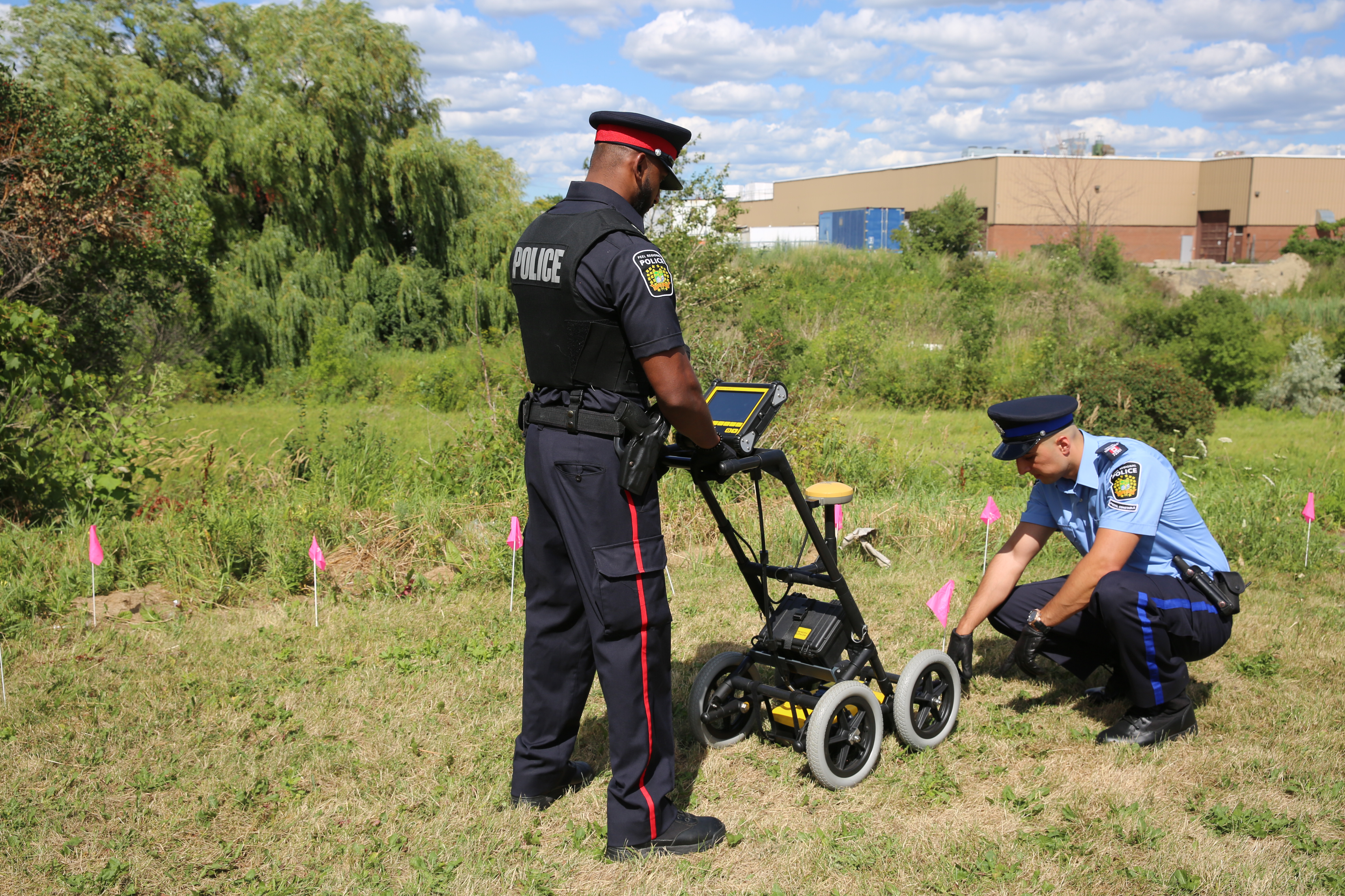
Utilities and local governments require that the location of underground systems be identified and marked. This helps in planning projects and preventing risks and hazards. The LMX200™ builds on the capabilities of the LMX100™ and adds additional functionality to help you locate and map these utilities. It adds a powerful grid scanning mode and the ability to use external GPS to take full advantage of SplitView and MapView. The advanced version of LMX200™ also allows you to export data for post-processing, archiving, linking and further mapping capabilities.
The LMX200 is a ground penetrating radar (GPR) system manufactured by Sensors & Software Inc. It is designed for non-destructive subsurface imaging, allowing users to visualize and map underground features and utilities. Here’s an overview of the LMX200 GPR system:
- Principle of Operation: The LMX200 operates based on the principle of sending radar pulses into the ground and analyzing the reflected signals to create images of subsurface features. It emits electromagnetic waves into the ground and detects the signals reflected back from underground structures, utilities, and anomalies.
- High-Resolution Imaging GPR LMX200: The LMX200 produces high-resolution images of the subsurface, allowing users to visualize features such as pipes, cables, voids, rebar, utilities, and geological formations. The system provides detailed information about the depth, size, and location of these features.
- Real-Time Data Acquisition GPR LMX200: The LMX200 provides real-time data acquisition and processing capabilities, allowing users to view live radar images of the subsurface directly on the system’s display screen. This feature enables immediate on-site analysis and interpretation of the data.
- User-Friendly Interface GPR LMX200: The LMX200 features a user-friendly interface with intuitive controls and menu navigation, making it easy for operators to configure settings and interpret the radar data. It typically includes software for data processing and interpretation.
- Versatile Applications GPR LMX200: The LMX200 is suitable for a wide range of applications, including utility locating, infrastructure assessment, geological mapping, archaeological surveys, environmental studies, and concrete inspection. It can be used in various ground conditions, including soil, sand, gravel, asphalt, and concrete.
- Portable Design: The LMX200 is designed to be portable and easy to transport, allowing for flexible deployment in the field. It is typically housed in a rugged and durable enclosure that protects the system’s components from dust, moisture, and mechanical shock.
- Integrated GPS: Some models of the LMX200 may feature integrated GPS functionality, allowing users to geo-reference the detected subsurface features and create accurate maps of underground infrastructure.
- Battery-Powered Operation: The LMX200 is powered by internal batteries, providing convenient and portable operation in the field. The system typically offers long battery life to support extended use during subsurface imaging tasks.
Other products in category GPR