


Description
CGO20 RTK in Uzbekistan, Tashkent
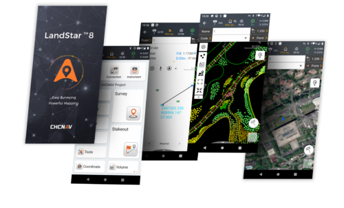
RTK module is designed for operations with LandStar7 software project data also using cloud technologies:
viewing and editing objects, changing the CS, shifting the base, calibration, working with code libraries, exporting to various formats, including custom ones.
The second version of the popular CGO software product will delight you with the following innovations
- Updated interface for ease of use
- RTK module for working with LandStar7 software data
- Public cadastral map of Rosreestr
- Joint and separate processing of GLONASS, NAVSTAR GPS, BeiDou, Galileo data
- Import formats from various satellite equipment manufacturers, including RINEX
- Automatic quality control to ensure the reliability and validity of the resulting solution
- UAV module for processing PPK data from DJI drones and more.
CGO software allows you to process satellite data from all existing global navigation systems (GLONASS, NAVSTAR GPS, BeiDou and Galileo). The program is designed for post-processing of static measurements and measurements in kinematics (PPK) mode, as well as working with RTK projects by synchronizing data directly with the controller or cloud service.
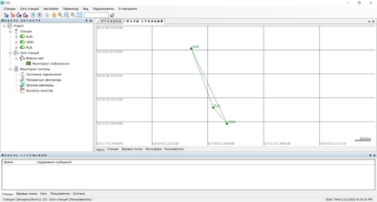
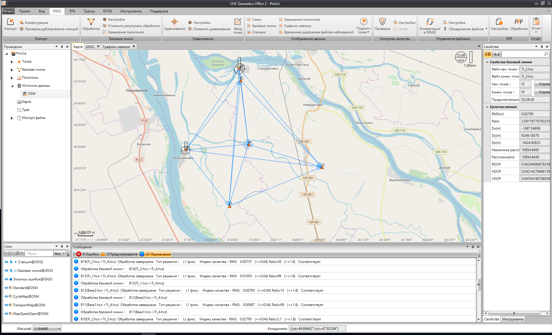
Viewing results using an online map service, for example, Google, OSM, Bing or the public cadastral map of Rosreestr, provides convenient control of the measurements performed.
Thanks to the modular structure of the program, you can configure the software in accordance with the tasks to be solved.
Main features of CGO software with all PP+RTK+UAV modules CGO20 RTK:
- Post-processing of static and kinematic observations
- Supports GLONASS, NAVSTAR GPS, BeiDou and Galileo data
- Availability of many formats for importing raw source data: RINEX v2.x, v 3.x, HCN, HRC, Novatel NOV, Trimble OEM BD9, uBlox.
- Import of airborne and high-precision ephemeris from the Internet
- Importing LandStar 7 projects from the controller
- Import data from FTP
- Control of source information during import of raw GNSS data
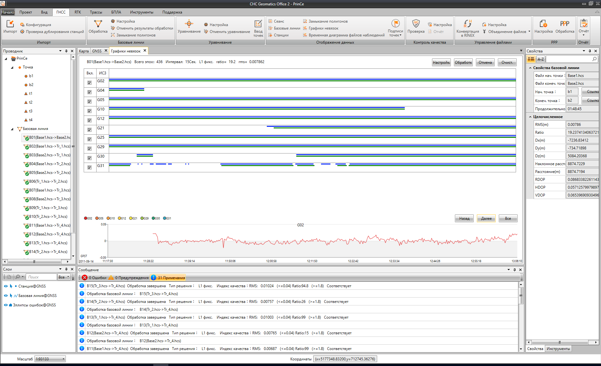
- Various types of reports in HTML format: Baseline processing, Network adjustment, Polygon closure
- Individual report settings to obtain all the necessary information
- Adjustment of processed vectors in a geocentric rectangular coordinate system with the ability to specify initial points in plan and height.
- Default support for parameters of the main Russian coordinate systems according to GOST (SK42, SK95, MSK-XX) CGO20 RTK
- Creation of custom coordinate systems with the ability to use geoid models CGO20 RTK
- Determination of communication parameters of an unknown system and WGS84 based on satellite CGO20 RTK geodetic measurements at GGS points with known coordinates (calibration) CGO20 RTK
- Uploading online maps as a background (Google, Bing, OSM, Rosreestr) CGO20 RTK
- Solving coordinate geometry problems using points on a map
- Ability to process offline static measurements using the PPP (Precise point positioning) method
- Export to various formats, incl. custom: txt, csv, dxf, shp, kml
- Data synchronization with the controller and cloud service CGO20 RTK
- CGO is a high-performance software product for processing satellite data CGO20 RTK
Here are the key features and functionalities of the CGO 2.0 RTK camera system:
- RTK Integration: The CGO 2.0 RTK camera system is equipped with RTK capabilities, allowing it to receive high-precision positioning data in real-time from RTK-enabled drones. This enables precise georeferencing of images and data collected during aerial surveys and mapping missions.
- High-Resolution Imaging: The camera system features a high-resolution sensor capable of capturing detailed images and videos with clarity. This enables users to capture high-quality aerial imagery for mapping, surveying, and inspection applications.
- Geotagging: With RTK positioning, the CGO 2.0 RTK camera system geotags each image with accurate geographic coordinates, elevation data, and timestamp information. This enables precise spatial referencing of the captured imagery and facilitates accurate mapping and analysis.
- Real-Time Image Correction: The RTK-enabled camera system can perform real-time image correction and georeferencing using the RTK positioning data received from the drone. This ensures that each image captured during the flight is accurately aligned with the ground truth coordinates, eliminating the need for post-processing adjustments.
- Integrated Camera Controls: The CGO 2.0 RTK camera system typically integrates camera controls directly into the drone’s flight control software or ground station app. This allows users to adjust camera settings, capture images, and control image acquisition parameters directly from their mobile device or ground control station.
- Remote Image Viewing: Users can remotely view live images and video feed from the CGO 2.0 RTK camera system in real-time during flight operations. This provides visual feedback to the operator and enables them to monitor the survey area and ensure data collection quality.
- Compatibility with Mapping Software: The captured imagery and data from the CGO 2.0 RTK camera system are compatible with various mapping and photogrammetry software packages used for processing aerial imagery, generating orthomosaics, digital surface models (DSMs), and 3D reconstructions.
- Versatile Applications: The CGO 2.0 RTK camera system is suitable for a wide range of applications, including precision agriculture, land surveying, infrastructure inspection, environmental monitoring, and disaster assessment. Its high-precision georeferencing capabilities make it particularly valuable for applications requiring accurate spatial data.
Overall, the CGO 2.0 RTK camera system offers high-precision georeferencing capabilities, enabling RTK-enabled drones to capture accurate aerial imagery for mapping, surveying, and other precision applications. With its integration of RTK technology and high-resolution imaging capabilities, it provides a valuable tool for professionals seeking to collect accurate spatial data from the air.
Other products in category Processing and adjustment of satellite geodetic networks