Garmin GPSmap 65S

GPSmap 65S

The rugged, portable navigator offers optimal tracking accuracy, a 2.6″ color display and preloaded maps.

Category:

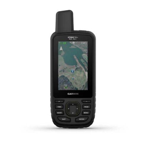
Technical characteristics

Options
  • GPSMAP 65s
  • Map “Roads of Russia. Russian Federation. TOPO.”
  • Mount with carabiner
  • USB cable
  • User Guide
Glonass Yes
Belt clip
Operating temperature from -20 degrees C to +50 degrees C
Dimensions 6.1 x 16.0 x 3.6 cm
Display dimensions 2.6″ (6.6 cm)
Display resolution 160 x 240
Display type Transflective, 65-K color TFT
Weight 217 g with batteries
Battery type 2 AA batteries (sold separately); NiMH or Lithium Ion (recommended)
Battery life 16 hours
Waterproof Yes(IPX7)
Highly sensitive GPS receiver Yes
Loaded maps Yes
Ability to install maps Yes
Base map Yes
Internal memory 16 GB
Using memory cards Yes
Memory card type microSD™ card (not included)
Number of waypoints 5000
Routes 200
Tracks 10,000 points, 200 saved tracks
Electronic compass Yes (with tilt compensation, 3-axis)
Barometric altimeter Yes
Special functions for geocaching Yes
Camera
Hunting/fishing calendar Yes
Sun/Moon Information Yes
Tide tables Yes
Area calculation Yes
Independent installation of POI points Yes
Creating an optimal route
View images Yes
Touch screen
Garmin Connect Yes
Advanced
  • GPS and GLONASS
  • PossibleDo not use different batteries
  • Bluetooth® wireless connection
  • Smartphone connectivity
  • Extended memory
  • Increased number of waypoints
  • Supports BirdsEye satellite imagery (subscription must be purchased separately)

Sensors
GPS
GLONASS
Galileo
Barometric altimeter
Compass Yes (3-axis, tilt compensated)
GPS compass (while driving)

Smart features for everyday use
VIRB® Camera Remote Control
Compatible with Garmin Connect™ Mobile
Alerts from a smartphone on the navigator

Functions for outdoor activities
Point to point navigation
Compatible with BaseCamp™
Area calculation
Hunting/fishing calendar
Information about the sun and moon
Easy to use for geocaching Yes (no paper printouts required)
Compatible with custom maps Yes (500 custom map tiles)
Viewing Images

Applications for outdoor activities
Compatible with Garmin Explore™ app
Compatible with Garmin Explore website

Connections
Wireless connections Yes – Bluetooth®, ANT+®

Description

GPSmap 65S in Uzbekistan, Tashkent

Extended GNSS support

Multi-band technology and advanced GNSS support (GPS, GLONASS, Galileo, QZSS and IRNSS) provide optimal accuracy in mountainous terrain, near tall buildings and in dense forests.</p >

ABC sensors

The device includes ABC navigation sensors – an altimeter for altitude data, a barometer for weather monitoring and a 3-axis electronic compass.

Preloaded Topo Maps

Preloaded, routable Topo maps provide detailed views of roads, waterways, natural features, land use areas, buildings, and more. Maps “Roads of Russia. Russian Federation. TOPO.” are unique in that they combine three separate products. Firstly, these are road maps with address routing and search, secondly, these are topographic maps with elevations and types of vegetation, and thirdly, these are maps of the depths of inland bodies of water with navigation information and water infrastructure. The maps include full coverage of the Russian Federation. Maps are updated regularly.

MicroSD memory card slot Garmin GPSmap 65S

Using a compatible device and a microSD card slot, load TOPO 24K maps and hit the road.

Smartphone alerts Garmin GPSmap 65S

Receive emails, text messages and alerts directly to your portable navigation device when paired with a compatible device.

GARMIN EXPLORE App Garmin GPSmap 65S

Plan, view, and sync waypoints, routes, and tracks using the1 app and the Garmin Explore website. You can view your completed classes even before you return home.

Geocaching

Get automatic cache updates from Geocaching Live, including descriptions, logs, and hints.

Other products in category  Navigators