Description
GPSmap 66SR in Uzbekistan, Tashkent
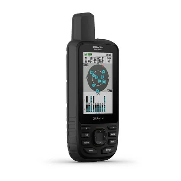
Extended GNSS support
Multi-band technology and advanced GNSS support (GPS, GLONASS, Galileo, QZSS and IRNSS) provide optimal accuracy in mountainous terrain, near tall buildings and in dense forests.</p >
ABC sensors
The device includes ABC navigation sensors – an altimeter for altitude data, a barometer for weather monitoring and a 3-axis electronic compass.
BirdsEye satellite images
Download realistic, high-resolution maps directly to your device without an annual subscription. Using these maps you can easily find trails, select parking spots, create waypoints, etc.
Preloaded maps “Roads of Russia. Russian Federation. TOPO.”
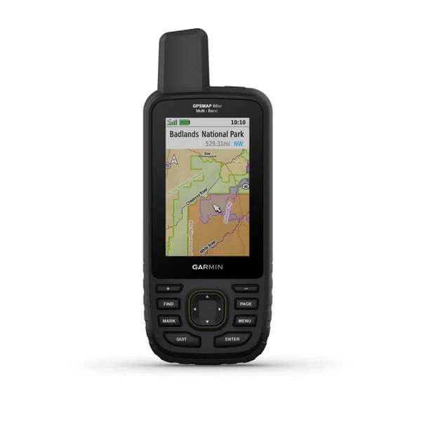
Preloaded, routable Topo maps provide detailed views of roads, waterways, natural features, land use areas, buildings, and more. The cards are unique in that they combine three separate products. Firstly, these are road maps with address routing and search, secondly, these are topographic maps with elevations and types of vegetation, and thirdly, these are maps of the depths of inland bodies of water with navigation information and water infrastructure. The maps include full coverage of the Russian Federation. Maps are updated regularly.
Active Weather
When paired with a compatible smartphone, you get up-to-date weather information and weather radar to keep you up to date on weather conditions.
Made for adventure
This device meets military standards for temperature, shock, and water resistance (MIL-STD-810). In addition, the device is compatible with night vision goggles.
LED flashlight
The GPSMAP 66 line helps reduce equipment footprint by offering a built-in LED flashlight that can also be used as a beacon.
Geocaching
Get automatic cache updates from Geocaching Live, including descriptions, logs, and hints. When connected using Wi-Fi® technology or the Garmin Connect™ 2 app, each geocache found will be uploaded to your Geocaching.com profile.
GARMIN EXPLORE™ App
Plan, view, and sync waypoints, routes, and tracks using the Garmin Explore app2 and website. You can view your completed classes even before you return home.
Battery life
Internal rechargeable lithium-ion battery provides up to 36 hours of use in GPS mode and up to 3 weeks in Expedition mode.
The Garmin GPSMAP 66sr is a rugged handheld GPS device designed for outdoor enthusiasts, hikers, backpackers, and adventurers who require reliable navigation and mapping capabilities in various environments. Here are some key features and aspects of the Garmin GPSMAP 66sr:
- Multi-GNSS Support: The GPSMAP 66sr supports multiple global navigation satellite systems (GNSS), including GPS, GLONASS, Galileo, and QZSS. This ensures better satellite coverage and more accurate positioning, especially in challenging environments with limited sky visibility.
- Topographic Mapping: The device comes preloaded with topographic maps and supports BirdsEye Satellite Imagery (subscription required), providing detailed terrain information for hiking, camping, and outdoor navigation.
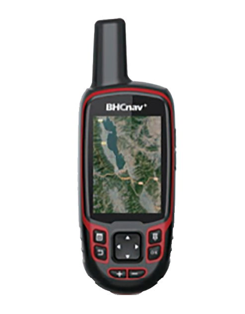
- Large Display: It features a 3-inch color display that is sunlight-readable and glove-friendly, allowing users to easily view maps and navigate the device’s menus in various lighting conditions.
- Rugged Design: The GPSMAP 66sr is built to withstand the rigors of outdoor use, with an IPX7 water-resistance rating and MIL-STD-810G durability standards. It can withstand dust, dirt, humidity, and accidental immersion in water up to 1 meter deep for 30 minutes.
- Wireless Connectivity: It offers Bluetooth and Wi-Fi connectivity for wireless data transfer, including sharing waypoints, tracks, and geocaches with other compatible Garmin devices and accessing live weather forecasts and geocaching.com data.
- ABC Sensors: The device includes an altimeter for elevation data, a barometer for monitoring weather changes, and a 3-axis electronic compass for accurate heading information, providing essential navigation tools for outdoor activities.
- Geocaching Features: The GPSMAP 66sr supports geocaching with preloaded caches and paperless geocaching features, allowing users to download geocache details directly to the device and log finds without paper.
- Battery Life: It is powered by a rechargeable lithium-ion battery and offers up to 36 hours of battery life in GPS mode (up to 450 hours in Expedition mode with optional AA batteries), ensuring extended outdoor use between charges.
Overall, the Garmin GPSMAP 66sr is a high-performance handheld GPS device with advanced navigation features, rugged durability, and long battery life, making it an ideal companion for outdoor adventures and exploration.
Other products in category Navigators